- DRI Preliminary Tsunami Modeling Report -
Modeling a tsunami generated by the December 26, 2004 Earthquake , off the west coast of northern Sumatra, Indonesia
by
Shunichi Koshimura
http://www.dri.ne.jp/koshimuras/sumatra/
Disaster Reduction and Human Renovation Inst.
Mainteined by S.Koshimura
Last modified 29 December 2004.
Numerical modeling of tsunami was performed by using TUNAMI code of The Disaster Control Research Center, Tohoku University. The model is based on the linear shallow water theory of spherical co-ordinate system. Seismic deformation modeling is based on the theory of Okada (1985). The computational grid size is approximately 2 min. and 5 min.
Following model cases are mainly based on the revised CMT solution by Harvard University.
Model Condition
Governing equation Linear shallow water equations in spherical co-ordinate system Numerical scheme Leap-frog FDM Spatial grid size 2min. / 5 min. Temporal grid size 5 sec. / 10 sec. sec. Computational domain 2 min. grid : (15N,70E)-(15S,120E)
5 min. grid : (25N,20E)-(75S,120E)Bathymetry data 2 min. grid : Sandwell-Smith sea floor topography
5 min. grid : NOAA Etopo 5
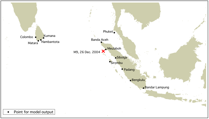
Model output
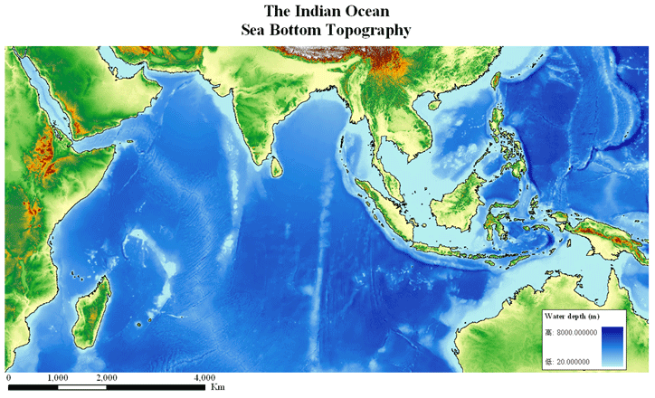
Sea bottom topography of the Indian Ocean
Model-6
1 st. segment (Southern part)
- (Strike, Dip, Slip) = (329, 15, 90)
- (L,W) = (500 km, 150 km)
- Dislocation = 11 m
- Depth = 10 km
2nd. segment (Northern part)
- (Strike, Dip, Slip) = (345, 15, 90)
- (L,W) = (400 km, 150 km)
- Dislocation = 11 m
- Depth = 10 km
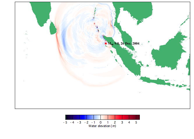
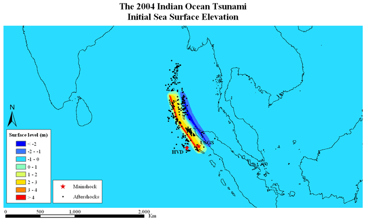
Seismic deformation
Model Results
Model-5b
- (Strike, Dip, Slip) = (335, 8, 110)
- (L,W) = (900 km, 150 km)
- Dislocation = 11 m
- Depth = 10 km
Seismic deformation
Model Results
retour au départ